Early this morning I set my sights towards the Niagara region again to take up the Bruce trail where I left off last. Once again I parked at Fireman’s Park and headed eastward into the forest. Note: having an old version of the trail map can be confusing when trying to figure out where you are. That being said I followed the blazes and hoped I would figure out where I was eventually.
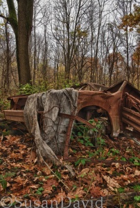
First little point of interest on this hike is a squished, rusted car sitting off to the left of the path. Not something you normally see on a hiking trail. Not sure how it would have gotten here but here it was.
According to the map I was going to pass a vineyard and I was pretty excited to see this. So along the path I travelled until I hit an unpaved side road and eventually an open field appeared before me. But wait, where were the vines? All I could see was muddy path, and a field of wildflowers. As I got further along the path I looked back to see a possible vineyard way up at the top of a hill. Okay so obviously this was not the year they were using this field to plant. Huh.
As I slipped and slid down the rest of the path (it was very muddy here) I finally came to a road that was to be my marker for heading back to the car. Something didn’t seem right and I didn’t feel this was the road that I was supposed to be on. On my version of the map I was to head down the road for a ways before meeting up with the forest again. Well, from where I was standing the trail continued into the trees across the road. Not taking any chances like we did on the first portion of the trail I decided to hike on.
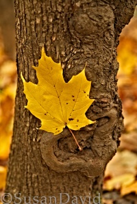
Soon I came to a large gully and a staircase that led me down to the river below. Beautiful yellow-leaved trees were everywhere here and with the leaves on the ground I had to stop and shoot. The trail continued again uphill down one edge of the gully and then around to the other side and kept going until finally I was out of the treeline and before me was….the QEW? Well how the heck did I get here? The map didn’t say anything about going over the QEW (there is a foot bridge over the highway). Obviously I’ve gone way too far and I still had to make it all the way back to the car. Yikes! It’s okay I made it back, barely. It was only about 8km total there and back. No biggie.
On the drive home I decided to take one more look for the cascade. Only two possible places left before I would give up for the season. My first choice ended up taking me to Scottsdale Farm so I thought why not stop for a quick shoot. The road to the farm was mud and large puddles. Now for those that don’t know I drive a beetle and I’m usually willing to drive on almost anything. Things that scare me the most are puddles larger than my car that I can’t see the bottom of. That’s what stopped me from going any further than I did. Still I was able to get off a few shots before heading back to the main road and the second possibility.
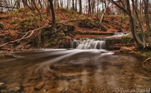
Eureka! I finally found it on what was my fourth try. (Hey at least I found it right?) This cascade is literally right beside a narrow bridge with some small gaps you could park in while not blocking traffic. Not that there was much traffic on this road. Jumping out of the car I ran right over to the cascade and took about 10 shots before….my battery ran out. Yup, after all of that the battery gave up. And yes I forgot my extra battery sitting beside the charger on my computer desk. This is not the first time ladies and gentlemen. Oh no I have done this before and quite recently. And on that last trip I had to use my point and shoot because I didn’t even have one battery with me. Alas, what can one do but trudge on and laugh about it.
Moral of the story: When you look for something hard enough eventually you will find it. And hopefully you will have an extra battery with you.
